Ocho Rios, Jamaica. February 2026. The Caribbean Princess is docked at the East Pier, and we're about to run a test that most navigation apps would fail before it starts.
The premise is simple: walk away from the cruise ship in airplane mode — no Wi-Fi, no cellular, no roaming — track the walking ETA and Return-to-Ship Safety guidance the entire way, then turn on data and compare against Google Maps.
The Setup
Standing at the pier, airplane mode goes on. No signal bars. No data connection. Just GPS — which works without internet, the same way it works on a hiking trail in the middle of nowhere.
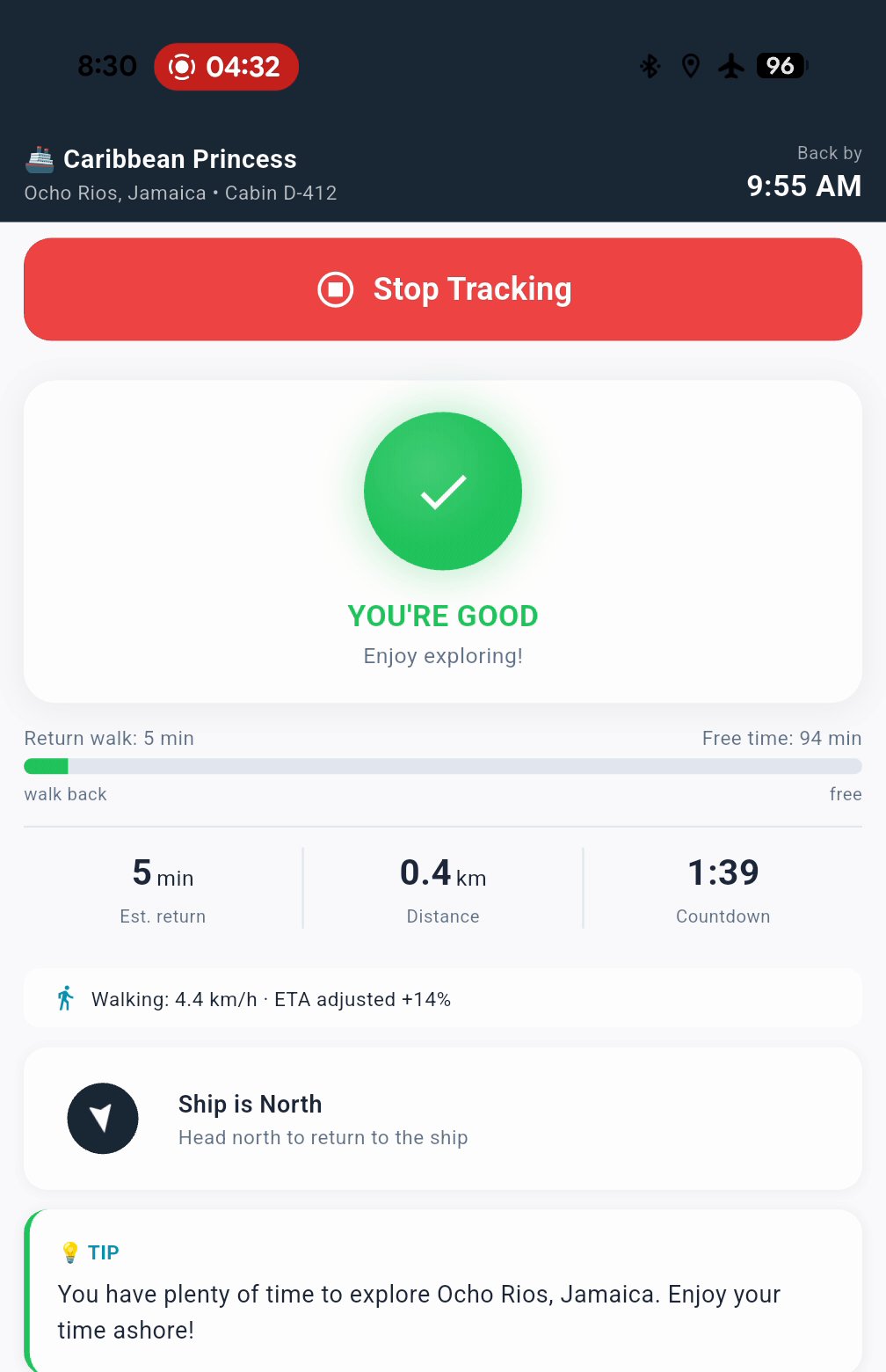
The app launches, locks position, and shows 1 minute walking ETA back to the ship. Because we're standing right next to it.
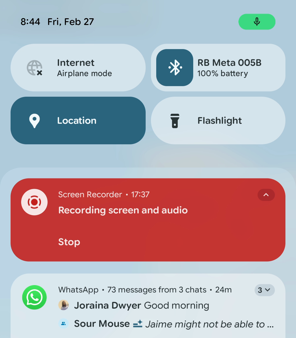
Airplane mode confirmed. 73 WhatsApp messages queued — zero connectivity.
Walking Out
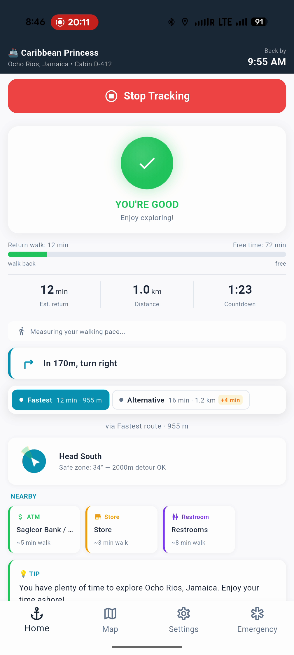
Over the next 17 minutes, the ETA climbs steadily as we walk into Ocho Rios. The Core tier tracks everything a passenger needs: walking ETA, distance remaining, compass direction back to the ship, and current walking speed.
Core tier dashboard. Note the airplane mode icon in the status bar — still completely offline.
Switch to the Navigator tier and the experience upgrades: route-aware walking guidance and nearby essentials — ATMs, restrooms, stores — all working offline. No data roaming charges, no "searching for connection" spinners.
Navigator tier: route-aware walking guidance and nearby essentials, all offline.
The Comparison
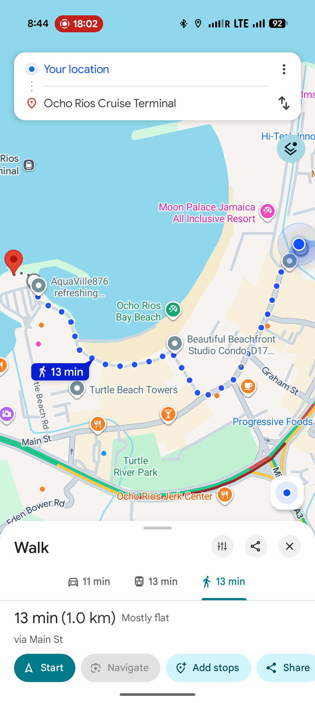
This is the moment that matters. After 17 minutes of walking with zero internet, we turn on data and open Google Maps. Destination: Ocho Rios Cruise Terminal.
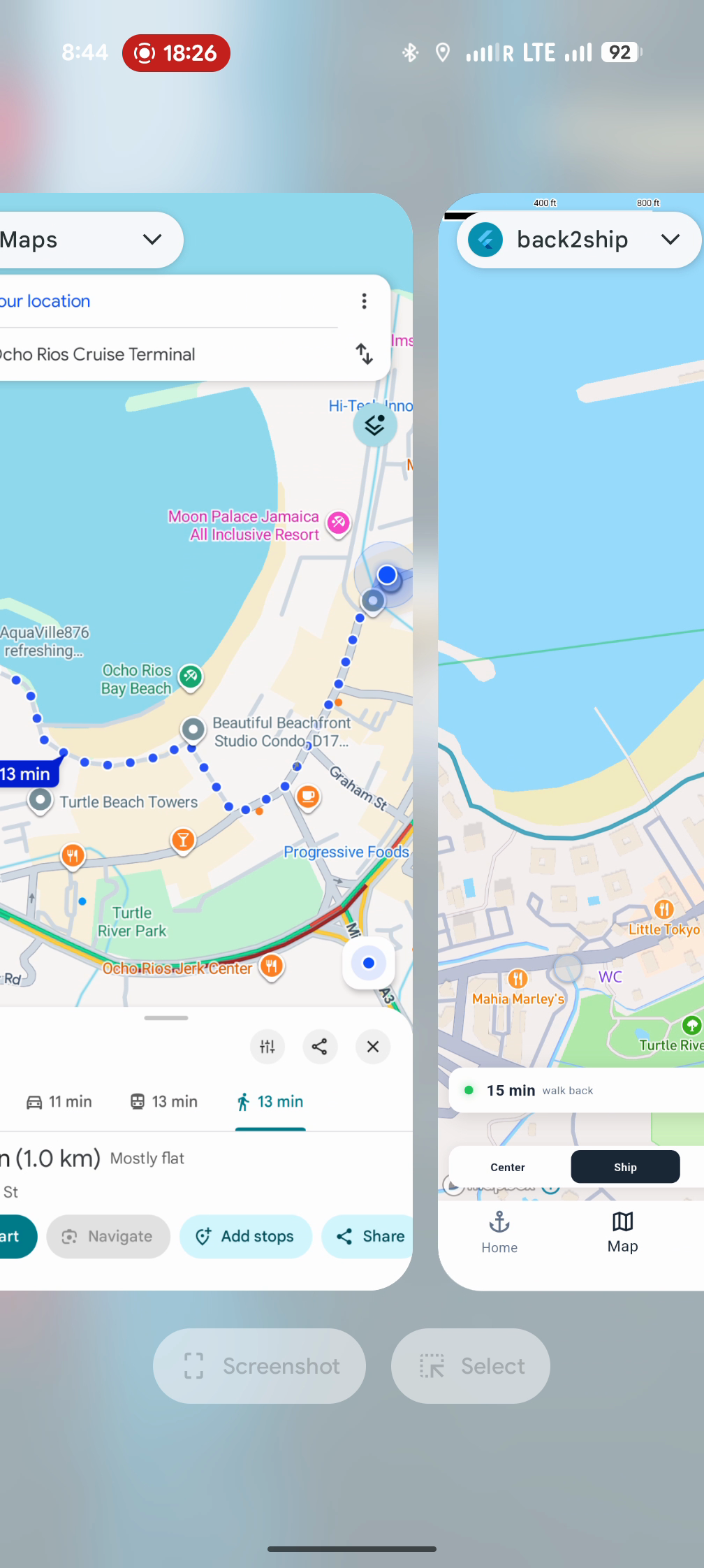
Google Maps says 13 minutes. ShipSafe says 15 minutes. The raw fastest route calculated by ShipSafe was actually 12 minutes — faster than Google's estimate.
So why does ShipSafe show 15? Because it measured the tester walking at 4.4 km/h — not the textbook 5.0 km/h that mapping apps typically assume — and added a safety buffer on top of that.
For cruise passengers, this is exactly the right call. A conservative estimate that gets you back to the pier 3 minutes early is infinitely better than an optimistic one that has you sprinting down the dock as the gangway pulls up. The goal isn't to match Google Maps. The goal is to make sure no passenger misses the ship.
Google Maps result for comparison — requires an active internet connection.
Rerouting Without Internet
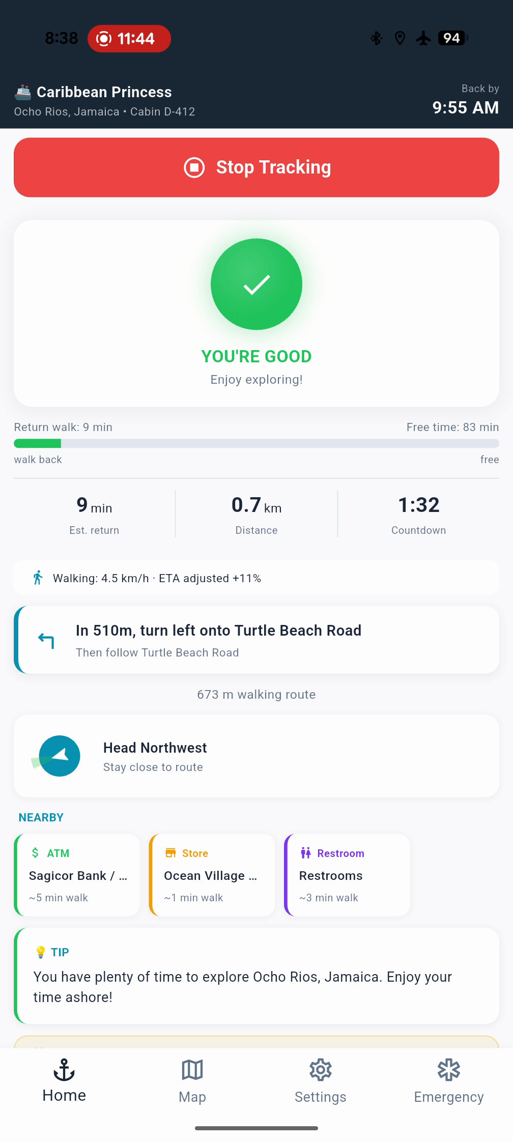
After the comparison, we tested another scenario that cruise passengers face constantly: taking a wrong turn in an unfamiliar port town.
The tester intentionally missed a turn. Within seconds, the app recalculated a new route — still in airplane mode. No "cannot find route" errors. No spinning wheel waiting for a server response. The new route appeared immediately and the ETA updated to reflect the longer path.
Full rerouted path after an intentionally missed turn. Calculated offline in seconds.
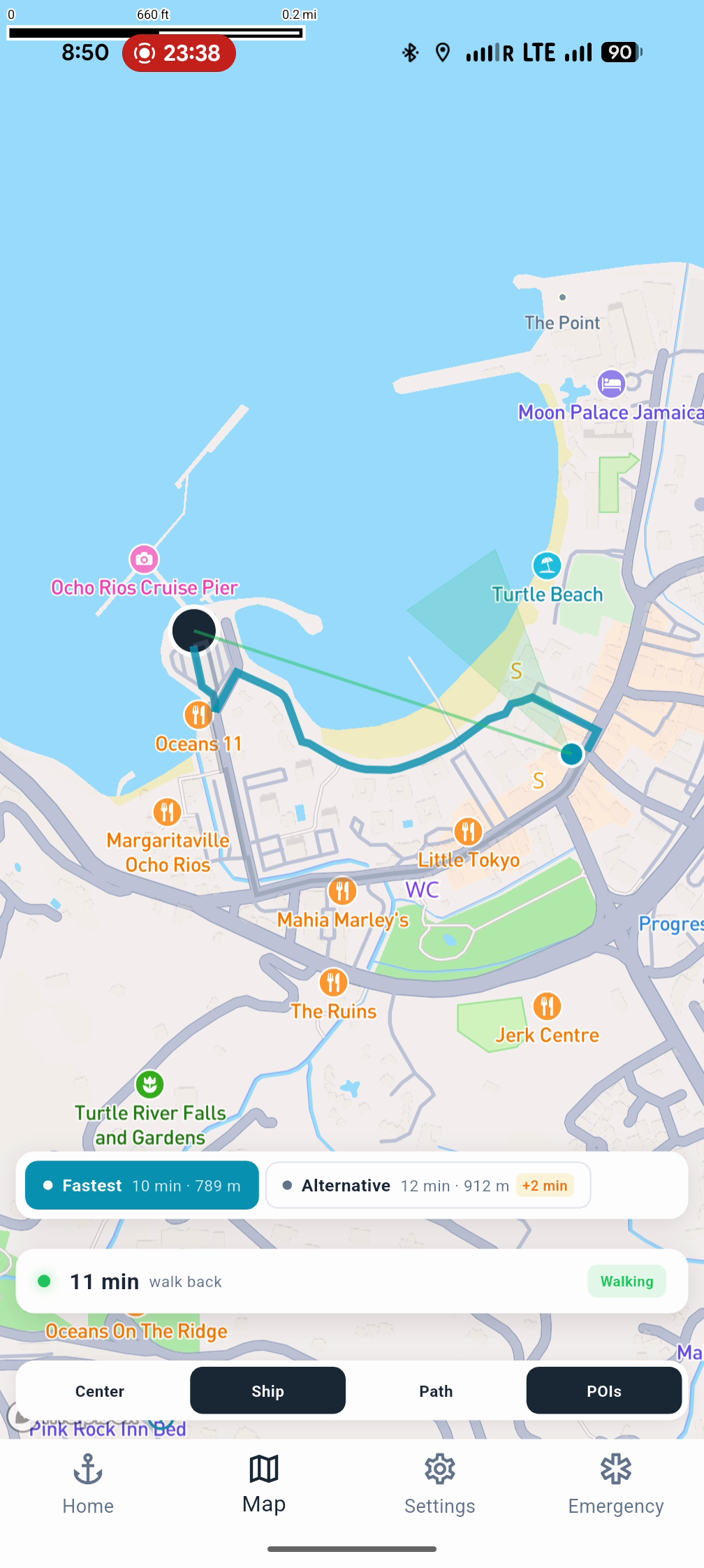
Multi-Route Alternatives
The Navigator Plus tier takes it further. Instead of a single route, passengers see multiple options — fastest route versus alternatives that might follow main roads or avoid steep hills. In Ocho Rios, the fastest route came in at 12 minutes while an alternative showed 16 minutes along a different path.
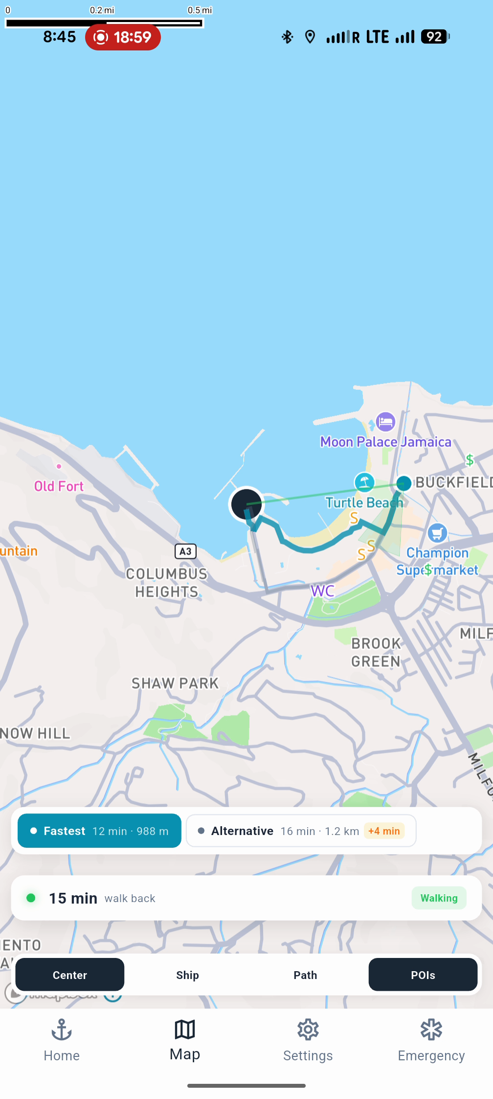
Navigator Plus: multiple route options, all calculated offline.
The Return
Walking back to the pier, the ETA counts down steadily. The app adapts as walking pace changes — slow down to browse a shop window and the estimate adjusts. Pick up the pace and it recalculates. No surprises.
At the end of the loop: 1 minute, 87 meters. The cruise ship is visible through the port fence. Full test complete.
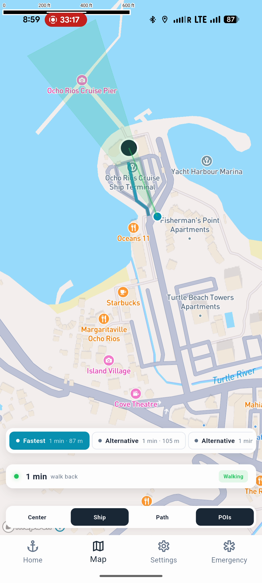
Loop complete. 1 minute, 87 meters from the pier.
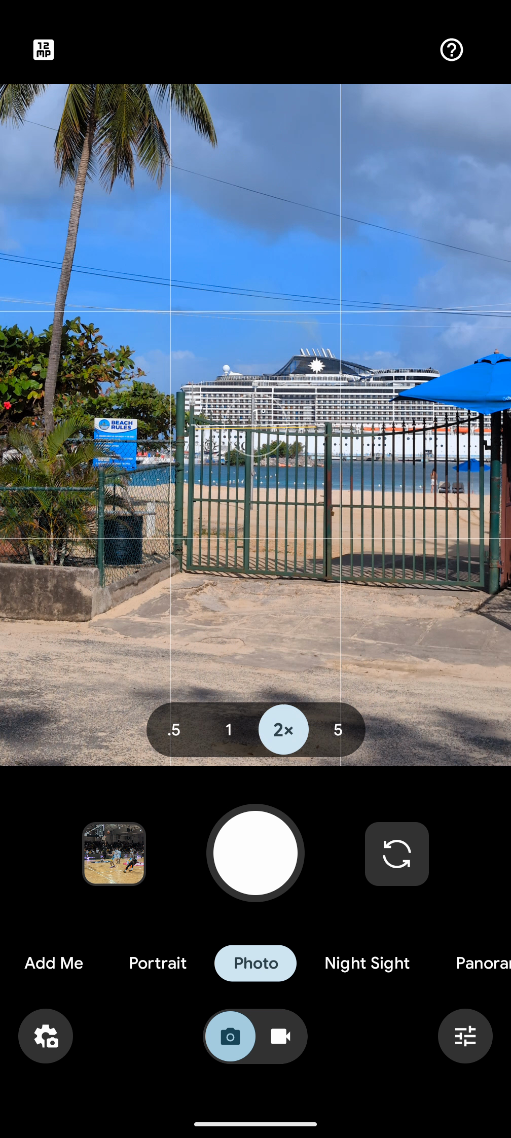
The Caribbean Princess, right where we left her.
What This Means for Cruise Lines
No internet dependency means no roaming concerns for passengers. This is critical — most cruise passengers either turn off data entirely when abroad or face exorbitant roaming charges. A safety system that requires internet is a safety system that won't work when it's needed most.
The SDK integrates into the cruise line's existing app. Passengers never download a separate app, never touch a settings screen, never configure anything. Boarding times, ship names, and port data are fed automatically. The system activates when passengers go ashore and watches the clock so they don't have to.
Proactive alerts escalate as departure approaches — a gentle nudge early, a firm warning when time gets tight, an urgent alarm when the math stops working in the passenger's favor. Three tiers let cruise lines choose the level that fits their app:
Core — Offline walking ETAs, pace-adjusted timing, compass bearing, departure alerts.
Navigator — Everything in Core plus route-aware walking guidance, nearby essentials, self-healing GPS, rerouting.
Navigator Plus — Everything in Navigator plus multi-route alternatives and route comparison.
We're heading to Seatrade Cruise Global in Miami, April 13–16. If your cruise line is thinking about passenger return logistics, we'd love to show you the full demo in person.
Let's talk: info@shipsafesdk.com
ShipSafe SDK gives cruise line apps accurate offline walking ETAs and escalating alerts to prevent pier runner incidents.
Learn more about ShipSafe SDK →